Jan-Erik Gustafsson forecasts skating ice in Sweden and he has set up forecasts for a few cities in the US. The forecast takes into account temperature, wind and radiational cooling, solar heating, cloudiness as well as snow. Click here for his forecast page.
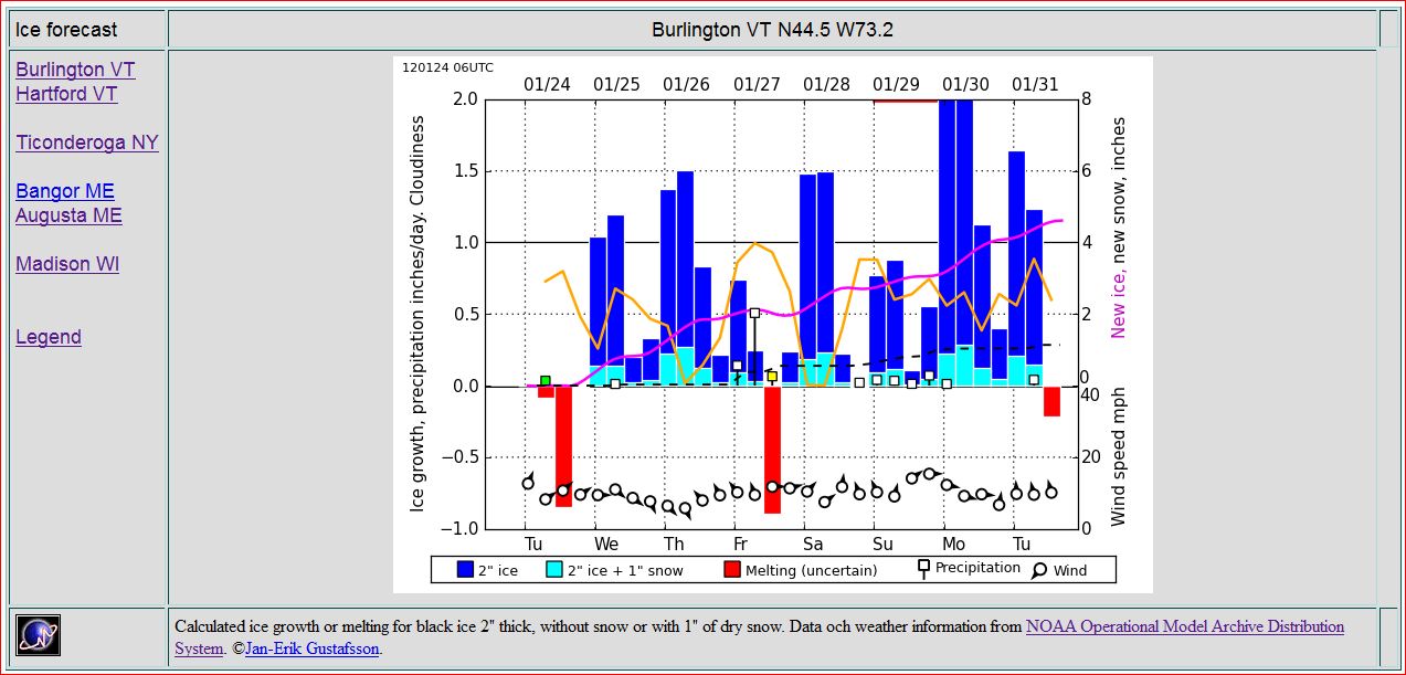 The forecast for Burlington VT 1-24-12
Jan-Erik's forecast projects ice growth from a thin skim (pink line). He also estimates the rate a two inch ice sheet will change in thickness (blue and red bars). If you average the four bars for a day you get how he expects the ice to change from two inches in a day. Dark blue bars indicate growth rate with no snow cover. The much smaller light blue bars show the dramatic insulating effect of an inch of snow. Red bars indicate melting which is hard to predict with reasonable certainty.
Skaters typically are looking for black ice that is at least two inches thick (sometimes thicker if weather is warm, if the lake is large or for a variety of other reasons). Once it gets near 8" it is much thicker than it needs to be for most skating locales. The forecast starts from a thin skim as that indicates when the body of water is cool enough to grow an ice sheet. Jan-Erik's forecast does not predict when open water is likely to catch. Local history of the 'first ice dates' combined with a idea of how much-warmer or colder the season has been in freezing-degree-days should give a reasonable idea of when it will come in. Obviously cold, clear, still nights are the most likely time to catch. Ice grows more slowly as it thickens. For example at 10 deg F a 2" sheet may add an inch in a day. Starting at 6" it will add about half as much. (More on growth rates)
As with all predictions based on something as complex as the weather, this one should only be used as an estimate of what will happen, particularly as the forecast gets out more than a couple days. As always, the ground truth on the ice is what really counts. For that you need to carefully check the ice out yourself (see the November 23, 2011 blog entry below for more discussion of ice checking).
All this is made possible by data provided by NOAA.
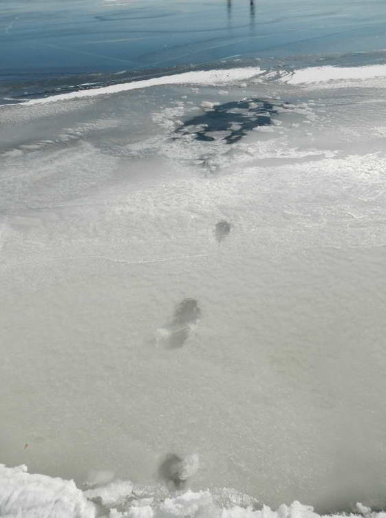
 Truck in 12 feet of water near Alburg Vermont. Went through at a pressure ridge. The ice within a couple feet of the center of the ridge was two layers, each about 4-5" thick. Note the track leading to the hole.
  robertdill