Double Ended Folded Ridge
In the 2012 season, on Shelburne Pond (NW Vermont) we found an unusual and persistent folded pressure ridge. It was basically a 1/2 mile long folded ridge that did not connect to shore or another ridge. This lack of connection is not typical for pressure ridges which almost always a connection on at least one end to the shore, often through a system of ridges. It occupied the north end of the pond from the time the ice came in fully to when it went out in early March.
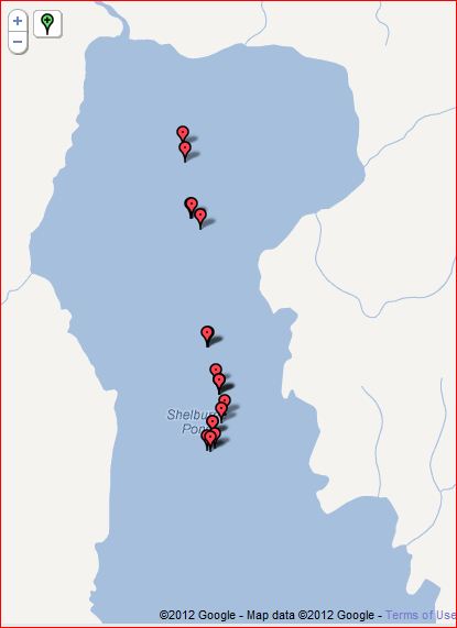
The markers of the map of Shelburene show the locations of pictures taken along the ridge system in mid January 2012. At that time there was a section in the middle that was a techtonic crack rather than a folded ridge. Later in the season the southern end of the ridge froze and thickened.
At times the ridge had large areas of open water ( up to 100 feet wide by 300+ ft long). When the large open water stretches refroze there was lots of thin ice. By early February the old ice to the sides of ridge was thinner near the ridge and tapered to full plate thickness over about 350 feet.
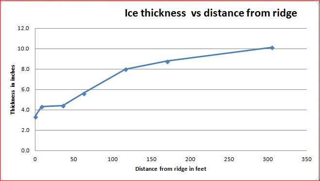
We suspect the tapered thickness along the sides of the ridge were related to wind driven convection in open areas of the ridge. It may be that as the cold surface water was blown down wind more cold water flowed in from the sides. In this scenario the upwind/underice cold layer would become depleted allowing warmer water to erode the bottom of the ice sheet. The ice thickness by late January was consistently the same everywhere on the pond except within about 350 feet of the ridge itself.
We did numerous water temperature profiles of the pond water and made some crude attempts to measure under ice current directions and speeds (our test method for current was too crude to tell us anything useful).
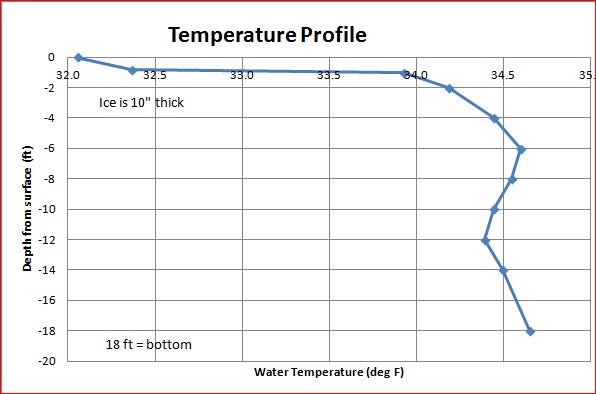 Typical temperature profile of the pond.
 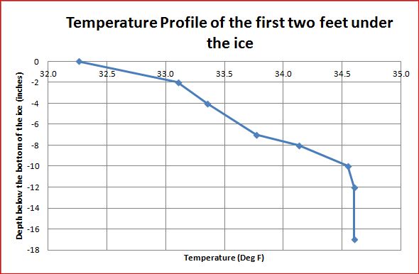 The cold under-ice transistion layer is about 10" thick.
The temperature profiles at the ridge edge and other places on the pond were quite similar suggesting that water temperature distribution was not a factor in keeping the ridge active. We did not do temperature measurements at the beginning of the season when local temperatures may have influenced how the pond froze.
The ridge was the source of at least one swim by a solo, night time skater who now has considerably more respect for the seriousness of skating on full moon nights and the value of ice claws, test poles, life jackets and buddies with throw ropes and head lamps.
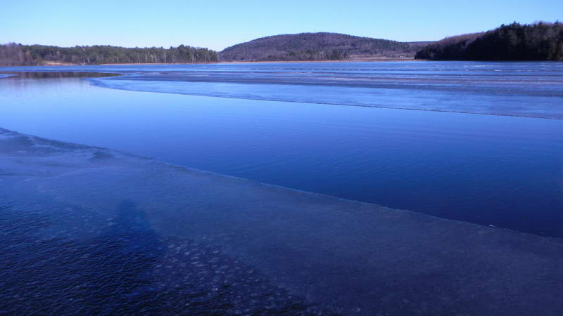 Open water in Mid December in the general area that became the double ended, folded ridge.
 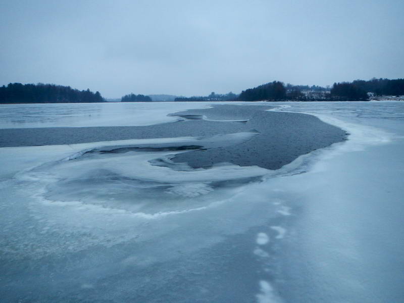 Late January after the warm weather had melted the ridge to a width of roughly 50 feet (it got wider later).
Progression over the winter:
The ice on the pond came in fitfully in December 2011. It froze completely then about half of the north end blew out in a strong NW wind. When that refroze and was thick enough for us to venture out on to we found the ridge was already active. In this early stage it had two sections that ran in about the same direction and had a latteral offset in between them. One snow storm resulted in a lot of slush in the open water which seemed to make the ridge less active but it got going again in a few days. About a week before the ice went out another storm seemed to heal things up again however the ice was getting too dodgy to go out on it so we do not know if the ridge reactivated during the last week of the ice cover.
As is typical of folded ridges there were tectonic cracks running out of both ends. These cracks extended to shore or to frozen ridges. The ends of the ridge were usually classic folded ridge ends with a broad shallow puddle on the end.
Working hypothesis:
It looks like the ridge formed in isolation early in the season shortly after the last areas of open water caught. They were thinner than the older ice and as the ice sheet went through its normal ratcheting contraction-expansion cycle it folded the thinner ice. Once the folded ridge was in place it continued to absorb the expansion of the ice sheet over the rest of the winter.
This year (2013) the ice expansion on Shelburne Pond is being absorbed by a shore ridge that runs just off shore of the access ramp: Score so far: One Car, One Truck, One snowmobile and one person (everything successfully recovered). The situation at Nubansuit Lake in 2011 may be another example of a double ended folded ridge system.
Bob, 2-17-2013
Note: The ratchet-contraction-expansion cycle typically occurs as follows: An ice sheet cools off at night and contraction cracks form. These partially freeze, holding the crack open. When the ice expands the next day, it is bigger than it was the day before. In this way the ice sheet grows over time. The extra ice sheet is consumed at pressure ridges or by shoving the ice sheet onto shores with a low slope. Reality is a bit more complicated but this gives the general idea.
