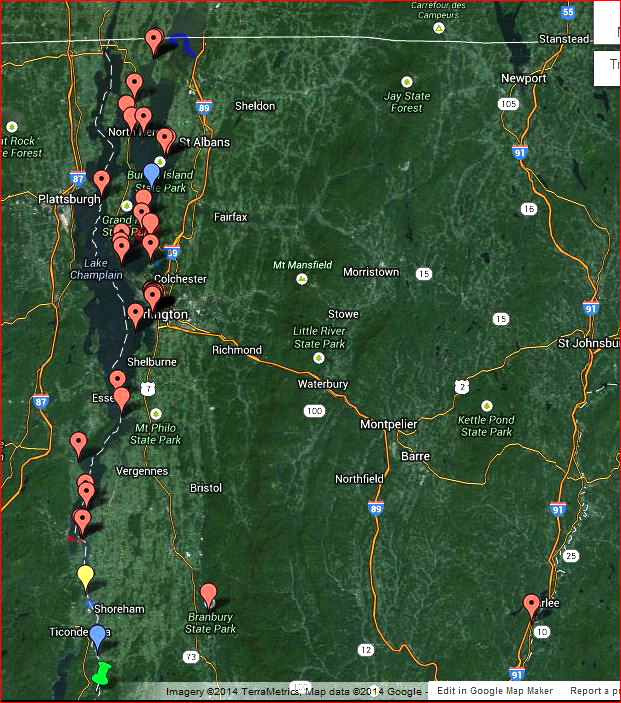
Screen capture of a google map showing known persistent hazards in Northern Vermont.
NOTE: There are a lot more hazards shown on lakes we know well than lakes that we do not. Lack of hazard markers usually means lack of knowledge about hazards rather than lack of hazards themselves.
Persistent Hazards
Some types of hazards can be found at the same place year after year. Gas holes are a good example. While some of them may freeze over in the cold part of the winter they reliably show up in the early and late parts of the season as well as after significant thaws. Reef and current holes are reliably found at the same locations.
Pressure ridges usually build out from points, across bay mouths and along the shore but they may not go to the same places on the ice sheet from one year to the next. I don't think it is necessary to include ridges for the most part. Reasons for this include:
- Their uncertain future location on an ice sheet.
- They are generally easy to see and anticipate (based on the profile of the shoreline).
- There are lot of them, more than we can realistically keep track of.
In cases where specific ridges or other types of hazards have a big impact on ice users, year after year, it makes sence to include them on the map.
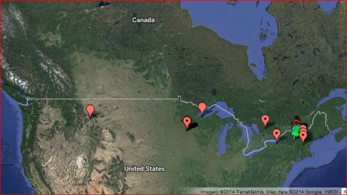
Persistant hazard locations in North America that we know about. There are far more that we do not know about. Get in touch if you have some to add to the map.
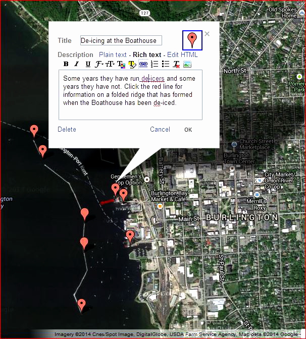
Screen capture of a google map showing known persistent hazards in Burlington Harbor. Most markers and lines have a note attached to them with some details about specific hazards.
The map is, of course, a google map.
The map is marked with markers and lines:
- Red is for hazards
- Yellow is for general hazard information or back ground
- Blue is for speculative information (eg there might be a hazard in a certain place)
- Green is general information
- Markers with dots are at a specific location
- Markers without dots indicate a general location.
- Markers show up at large map scales. Lines do not so many hazards are marked with both.
- Click on a marker or line to see information about the hazard.
