Leads
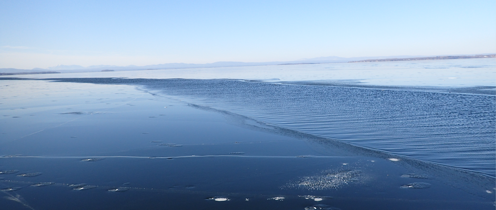
A 20 to 50 foot wide lead around Outter Mallets Bay, Looking southwest from near Red Rocks Point.
Leads are wide (2+feet) and long (many feet to miles) separations of an ice sheet. On lakes they are generally caused by high winds. They can create widespread treacherous ice conditions in the immediate area of the lead but also where the ice is pushed onto shore down wind of the lead and in random areas in between. In cold weather the damage from the lead formation typically refreezes for foot travel in a few days. If temperatures stay near or above freezing or strong winds occur, they can result in wide area of a mixture of open water, thin ice and broken plates.
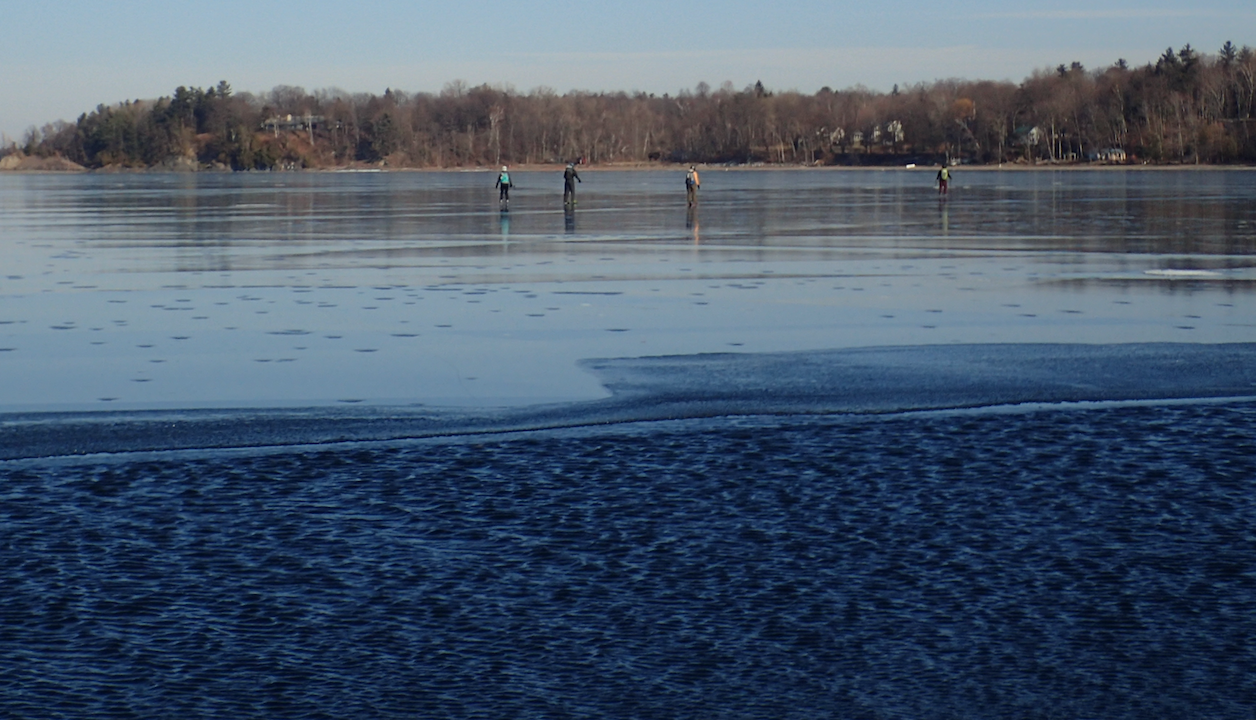 Some of the skaters looking for a place where the lead would let them get to shore. The beach in the background did the trick.
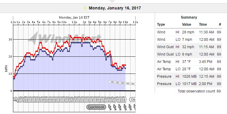
A speculative list of conditions that increase probability of lead formation. It is based on the conditions when the January 16, 2017 lead occurred (see below).
- Ice sheet size: approximatly2 miles . More wind fetch makes leads more likely.
- Ice condition: cold (warm, thaw weakened ice may form leads at less strong conditions)
- Ice thickness: 4" in the 1/16/17 event. Thinner or weaker ice will form leads more easily.
- Ice weakened in thaw conditions: Weak ice is more likely to raft, pull apart, or otherwise facilitate movement that becomes a lead (thaw weakening was probably not a factor in the formation of the lead described here).
- Wind around 30 mph. More wind makes leads more likely.
- Recent change in wind direction is a probable factor.
- Room to move: A lead is more likely if some room is available for the ice sheet to move into.
- Heating of the ice sheet:Warming of an ice sheet can create a lot of stress in the ice (generally much more than the the wind can apply). In the case temperature rose from 10 degrees at 6AM to 32 at 11 AM. It was sunny as well.
- pressure ridges: ridges often do not come in until the ice gets to around 4" thick. Ridge formation can create or relieve pressure on the ice sheet. This may create room which triggers lead formation.
The following is a is a report on a lead that cut off a group of skaters from their intended exit point from the ice. The bold text is for the report. Italic text is for captions that were added to pictures that were added to the report after it was published.
Report on a Lead Formation Event
Outer Mallett's Bay, Monday 1/16/2017
A group of 7 headed out from Bayside to skate Mallets Bay at 9am on Monday . Several of us had skated that same area on Sunday with wonderful results. The weather prediction for the day was sunny with temperatures starting at 20 and running up to 29 and a south wind of between 12 and 17 (MPH). When we started out, conditions seemed perfect, though windy.
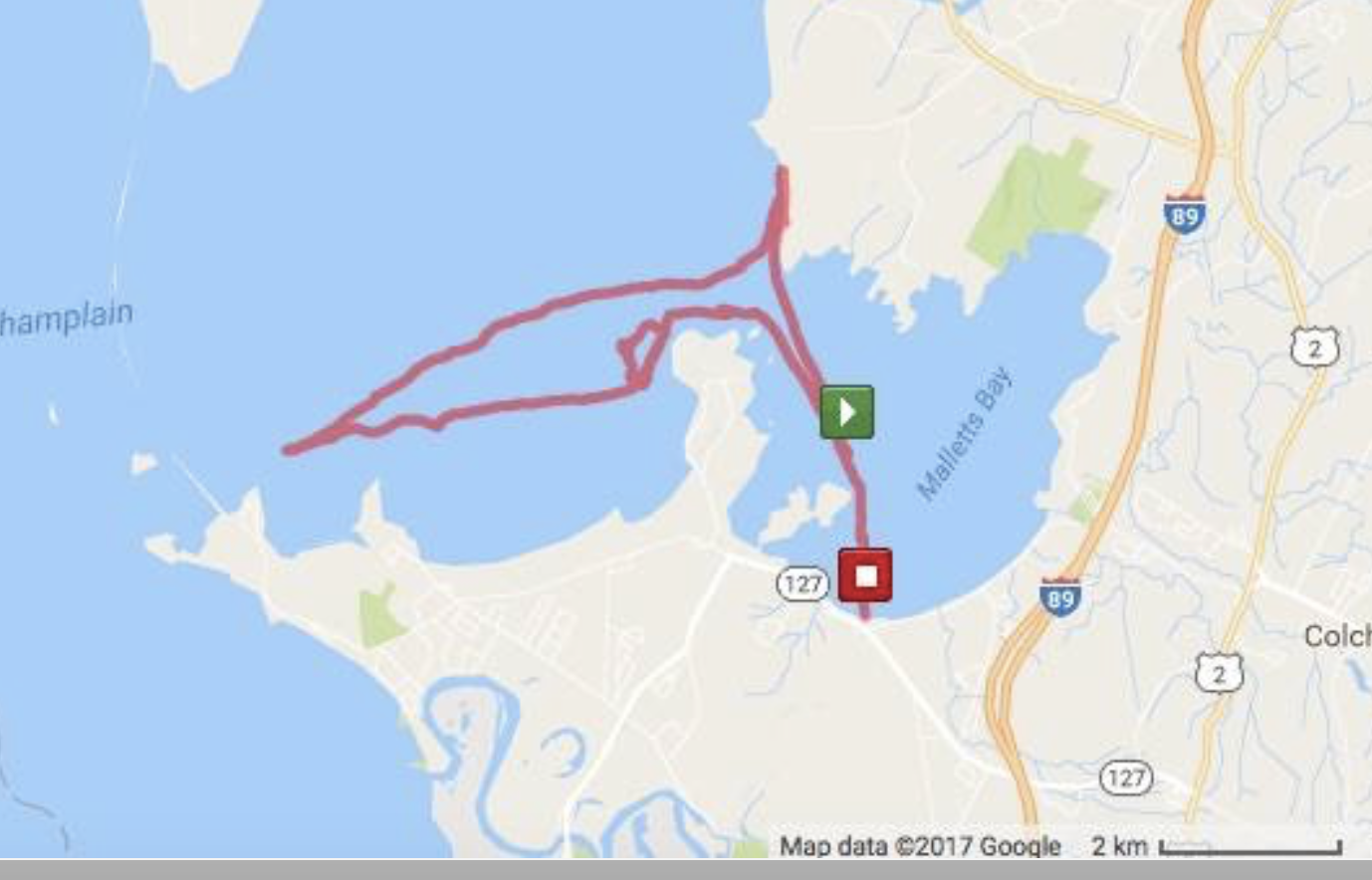
GPS track of the skating group. There are three, north directed points of interest described from east to west. The first is Mallets Head which seporates Inner Mallets Bay and Outer Mallets Bay. The second is Porter's Point and it is south east of the track turn around point. The third is Mill's point which is southwest of the track turn around point.
We skated out into the Outer Bay, finding ice that was about 3 to 4" thick and it appeared to be stable. We were going with the wind at that point, so the skating was easy. After rounding Mallett's Head, we decided to skate towards the south into the wind. We were looking forward to a downwind run back. The wind grew a lot stronger, well over 25mph (Wind Alert clocked up to 32 at Colchester Reef). We headed a bit inland, running along the eastern shore of the outer bay, towards Thayer Beach and Porter's Point.
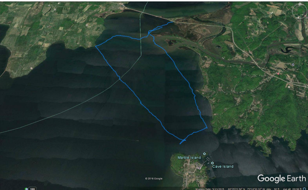 The above track is of another skater who came out in the mid after noon. He crossed a pressure ridge at the western corner of the track. He then skated SE across good ice (some wet cracks) to the lead just north of Marble Island. Then he headed NW along the lead and to just west of Red Rocks point. He followed the lead NW to Clay Point. After that he encountered the ridge on his way back to the car. It is likely that the ridge was the northern part of the lead. The room made by the ridge forming and the coincident high wind may have triggered the stress in the ice sheet to move north about 40 feet to form the lead. (from Bob)
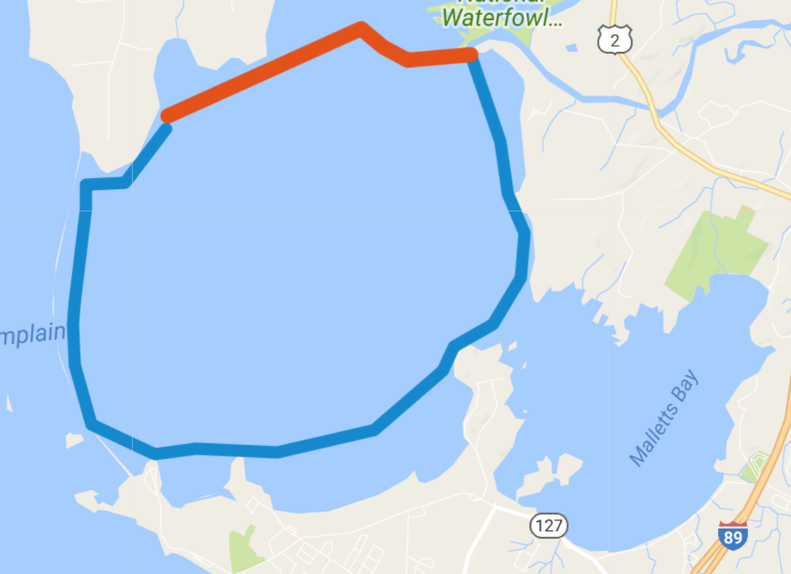 This is a speculative map for the lead during its first few hours based on the two GPS tracks. The blue line is the lead and the red line is the ridge. The western side and northern side are the most speculative. Over the next two weeks temperature hovered around freezing. Shifting winds seemed to push the ice from the south, or the north. Quite a few areas open areas developed, probably from this wind driven back and forth movement of the ice sheet.
We stopped to confer and suddenly heard a boom and a splash.
Editors note: The splash was witnessed by two of the skaters and generally described as a curtain of water that was a few feet high and a few tens of feet long. It separated into globs of water (surface tension and wind) and audibly splashed onto the ice surface. Nobody felt an obvious abrupt shift in the ice sheet they were standing that sometimes can be felt near where a pressure ridge shifts.
Between us and shore there was a 5-foot-wide gap in the very ice we had skated across not 45 minutes earlier, widening and impossible to cross. Suddenly our return by the way we had come was not an option .
So, we decided to head southwest, to Brian's house on Porter's Point, when we saw the gap had opened up between us and the south shore. It ran all the way to Porter's Point. Skating along the length of it, we hoped to round the end and make our way to land, however, it cut us off from getting off the ice at Porter's or Mill's Points. Later we saw that it stretched from Red Rock Point, past Mallett's Head, and along the southern shore of Mallet's Bay. We estimated it was about 3 miles long, and 15' wide in some places.
Now, the ice was cracking all around us and getting off was urgent. We decided to skate hard toward the Colchester Causeway to get onshore, but when we got close, the ice was rough, a mosaic of small old plates and chunks of ice with seeping water-- not an option. New breaks appeared as we regrouped.
I called Bob to apprise him of our situation. The whole group was reassured knowing that we were in contact with Bob and that he was on the Inner Bay.
Huge credit goes to two of our team, Brian and Diana. Their combination of geographical knowledge, ice knowledge and ice safety were a true gift to all of us, a few of us being still quite new to Nordic lake skating.
The course they chose was to run back across the middle of the Outer Bay, parallel to the larger cracks going east-west, and head for Clay Point. Now, the wind was at our backs, which helped us make speed. But as we progressed over this large area, new cracks appeared, many of which had water seeping up. Several plates were a little mobile as we traversed them, making it necessary to keep a distance from each other but still stay together.
We did, at last, manage to get all the way across to the beach between Clay Point and Red Rock Point. One of our party found a safe way all the way in to shore. I continued contact with Bob who was monitoring our progress. We made land (kissing the ground in one case). We saw Bob and his skating partner walking up the beach, having gotten off the ice at Red Rock Point. They helped us navigate back down the beach to the ice plate on the inside of open water and back into the Inner Bay. We then skated back to Bayside against a strong wind. Altogether we were out for over 3 hours and skated about 15 miles.
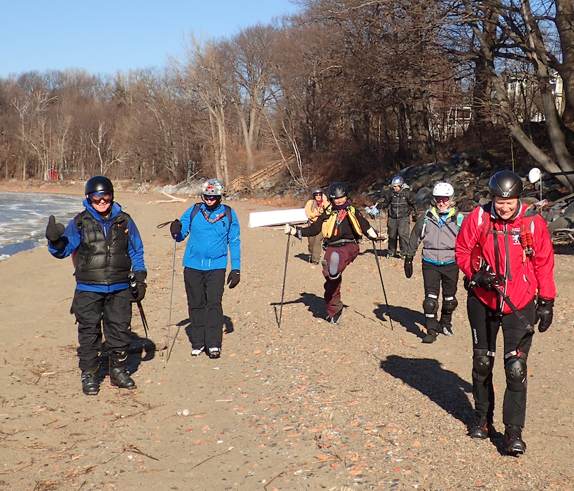 Happy Campers
Our group, worried as we were, worked together well. We kept up communication even as we needed to keep moving. Our singular goal was to safely get off the ice as soon as possible. With Diana and Brian in the lead, and one other keeping the rest of the group informed, we stayed together until we reached the end of the tour, dry and safe.
Bob, many thanks for your advice and support, and for meeting us at Red Rock Point.
Lessons learned?
Always hold awareness that the ice is changeable-- even after a couple of days of what seem like stable conditions and cold nights. In this case, it was high wind shifting the plate, not bad ice-- even good black ice can surprise you. And the wind changed direction overnight from north to south. Perhaps this was a factor as well?
All members of the party should travel with safety gear: ice claws, life jacket, throw rope, extra cell phone power, space blankets , test poles, clothes in a dry bag. See LakeIce.org for a thorough discussion of this.
For anyone wearing skates with blades that don't unclip, bring a pair of shoes in your pack in case there is need for a hike!
Comments and discussion are welcome.
Charlene
Click here for a short video of the lead described above.
End of Report
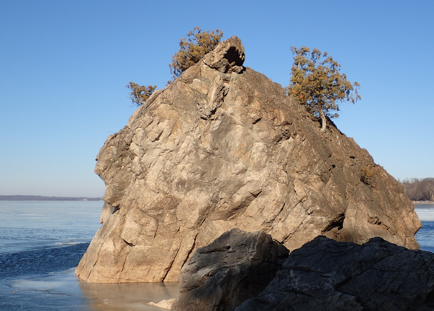
Near Redrock Point the lead can be seen just outside the block.
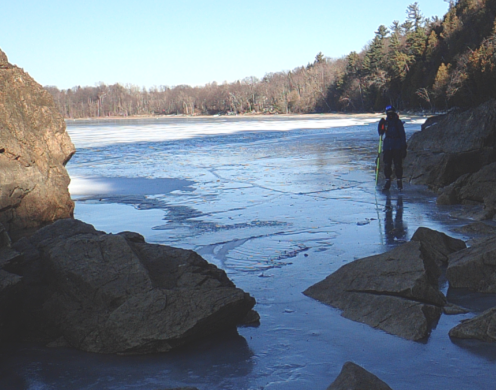 The hidden passage behind the block that gave access to plate that was east of the lead. Picture looking north toward the beach.
Looking north toward the block and beach. The stranded skaters had to walk about half way up the beach to find a place where they could cross with out getting their feet wet.
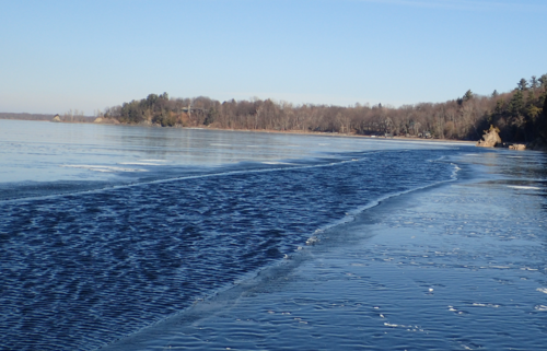
 Same position looking south across the entrance to the inner bay.
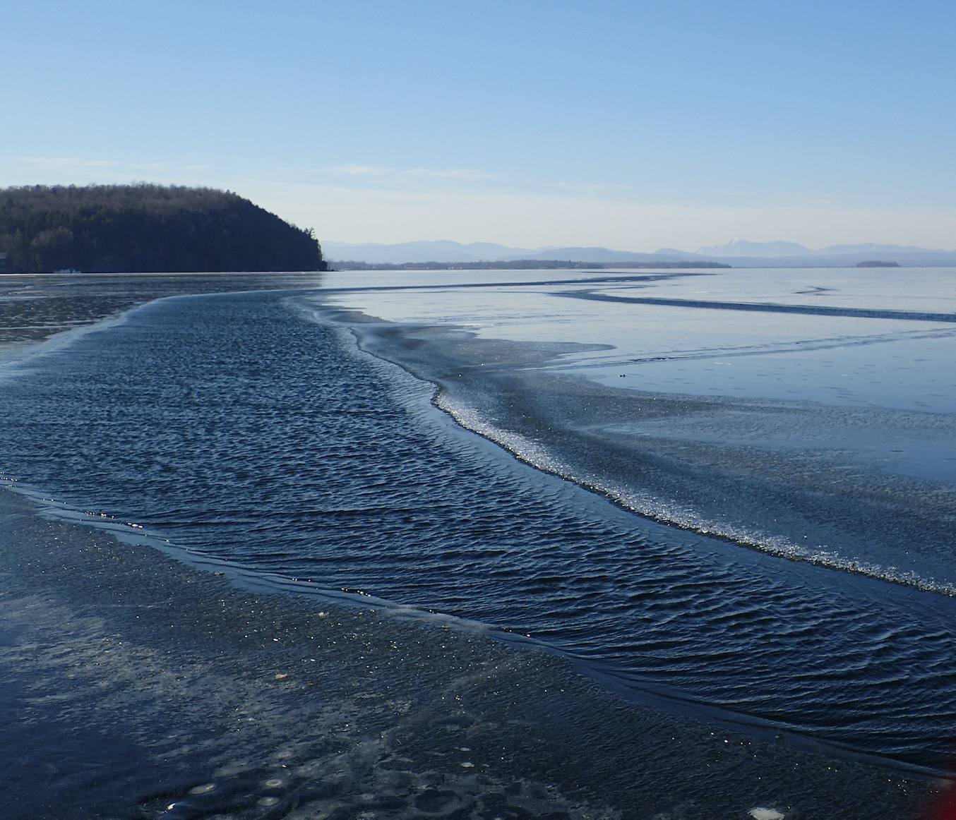
 The day after the lead formed it was calm...still water looks a lot like black ice. The lower diagonal line is the near edge of the lead....no time to be fiddling with your camera as you skate along.

