Under-ice Streams
Introduction
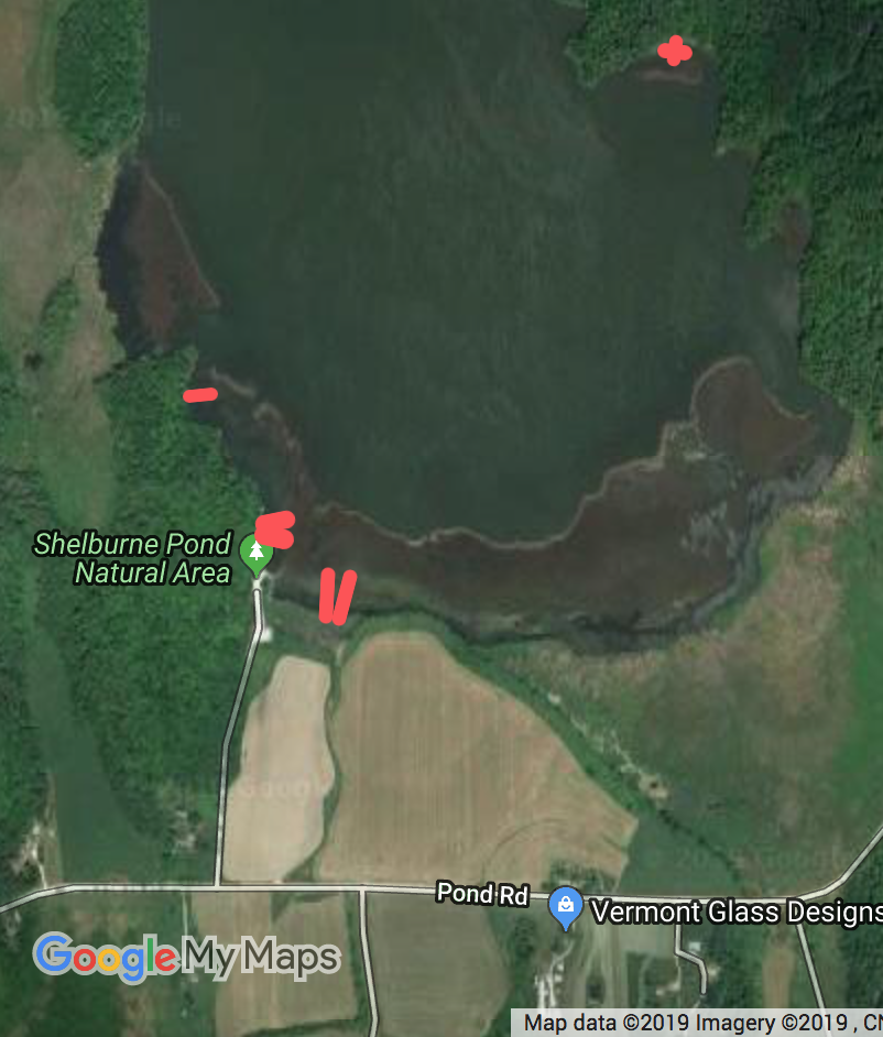
Shelburne Pond is one of our most popular skating ponds in the Burlington Vt area. About 20 years ago I found a peculiar narrow (2 feet wide) finger of thin ice that stuck about 100 feet out into Shelburne Pond in Vermont. It appeared to origionate in the cattail swamp on the south end of pond. I have looked for this ever since withouit success until this year when we found six of them.

Shelburne Pond with the under ice streams marked in red. The width in the red lines is exadurated.
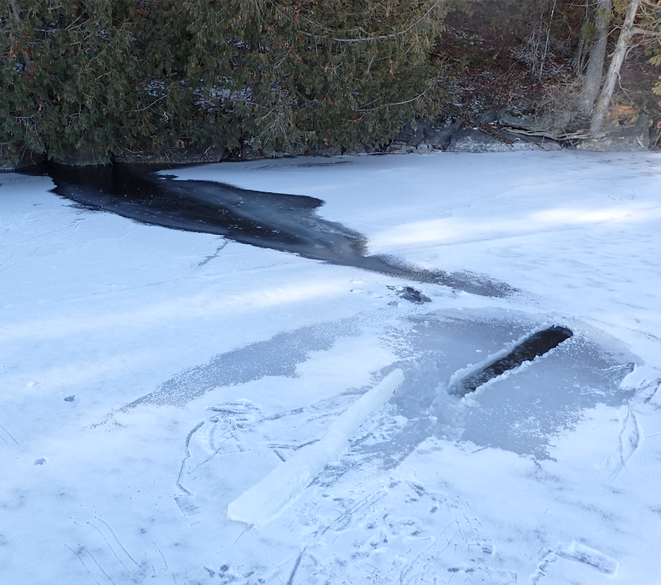
The is an upside down stream about 200 ft from the boat launch at Shelburne Pond. It is about a foot or a bit more wide. It is several tens of feet long. The ice is fairly well well thawed. The parallelism of the sides and the straightness is supprising.

 This is an upside down stream where it emerges from the base of a cliffIn the lower center of the image is a piece sawed out of the ice sheet. The saw hole is on the upper right side.
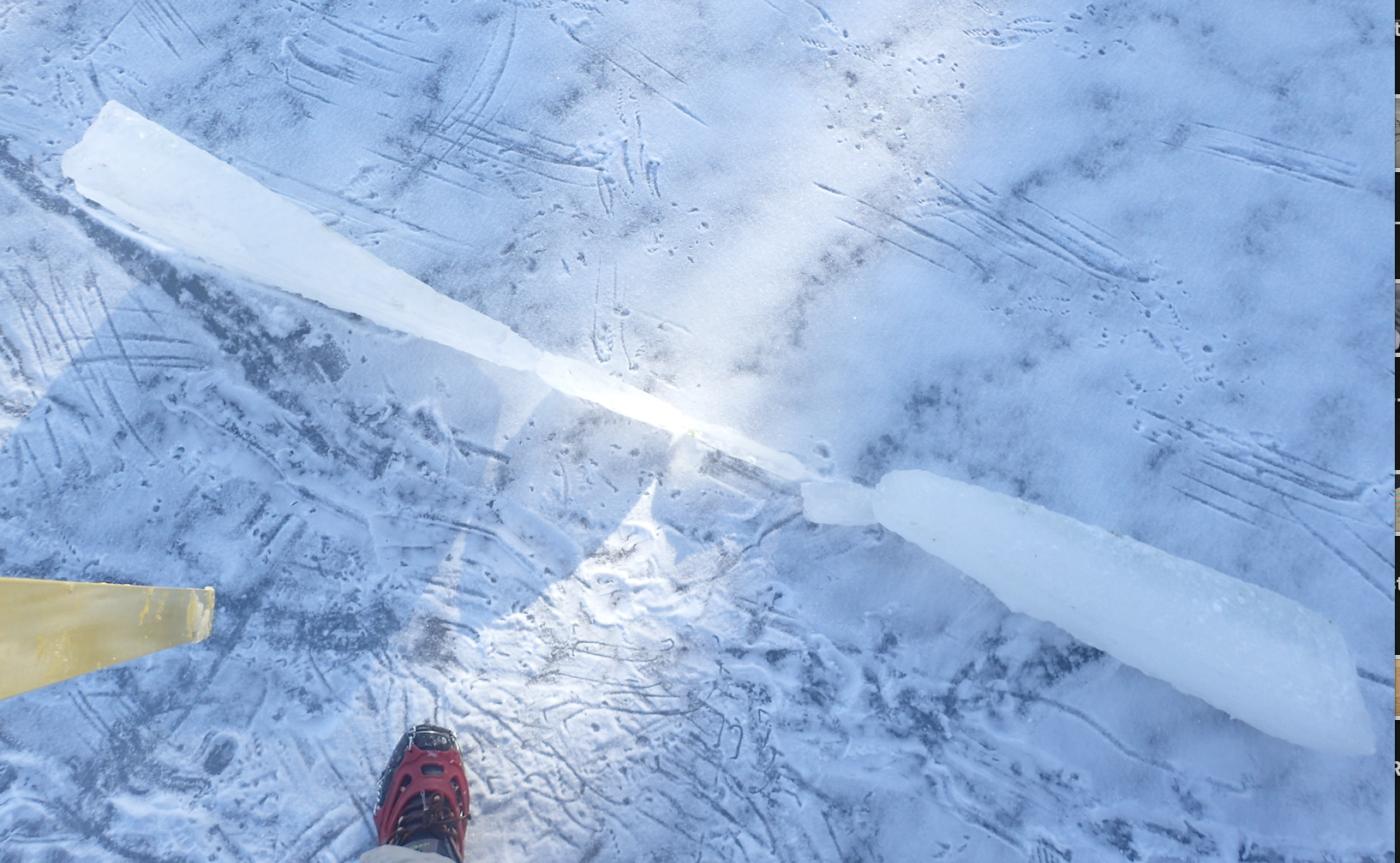
 This is an edgeon picture of a cross section of the stream channel. The ends are about 4" thick and the center is around an inch. The section broke in three pieces. The overall length is about 7 ft. 'Up' is tothe upper right.
The under ice streams erode the bottom of the ice with bands of thin ice or open water that appear to be related to groundwater flow from shore, perhaps injected under the ice as a shore based spring or stream. Their occurrence appears to be related to a warm January with little frost in the ground. The following factors appear to be some of the factors in their occurrence.
- Warm conditions (little frost in the ground to inhibit ground water flow). This can be either early in the season or mid-winter warm spells.
- Rocky ledges next to the ice (or nearby) and rock that has ground water passages. Rock layers that dip toward the ice sheet. Also swamps that have ground water moving through them can create underice streams.
- They are wider at the shore and extend up to 100 feet from shore, nearly perpendicular to the shore. They are usually less than 5 feet wide and quite straight.
- They are likely to occur at the same places when the conditions are right.
There is lots of bedrockor or swampy shoreline around Shelburne Pond. We only found thin ice from these streams in four places, three of them within 1/8 mile of each other.
Details:
I got the following from Doug, a friend, on January 29, 2017
Doug wrote: I headed over to Shelburne Pond this afternoon to check the ice and get in a quick skate with my wife and son. Access onto the ice requires ginger steps for the 1st 3', but once on it the plate was solid. A group of 3 fisherman was heading out as we were clipping our skates on. They relayed that a group that just left the ice reported 6"-8" of thickness.
Just as we were getting our skates on we heard a commotion and looked to see one of the party had fallen through. Moments later, another one of them fell through as well. The third person, who was trailing the other two, stopped and pushed his plastic tote-sled toward the hole for his partners (turned out to be his brother and his father) to grab. I pulled of my pack, got my throw rope, and started toward them, but they were both out of the ice, lying on it scootching toward the launch before I was needed.
The men were surprised and cold, but able to stand and walk off the ice once they felt it was solid. They were only about 300' from the launch access, directly North of it. It appeared that the rock bluffs may have warmed in the sun and weakened the ice near them.
I tested the ice and found I could not poke through with 4-6 stabs, it was at least 3" thick. I found a couple of recently frozen over fishing holes and found the ice thickness to be 4-6". The surface was a 5-6 grade. My wife was spooked by the fishermen's plunge and decided to hike the nearby woods trail. My son and I skated the Southern end of the lake for 20 minutes or so.
When we left the fisherman had changed and were still by their trucks warming up. I asked if they had ice claws. They did not, but admitted that they'd be a good idea. Fortunately, they will live to fish another day.
If you decide to skate Shelburne Pond, turn East (to your right) once you get onto the ice. Do not proceed due North from the launch. Give the rocks on the Western Shore at least 300' of space. As always, proceed with caution
End of Doug's report
When I got to the ice on January 30th the thin ice bands were still near breakthrough thickness in the area where the breakthroughs took place. The thin ice was a straight band of thin ice that was perpendicular to the shore. The three on the Southwest side of the pond origionated at the sloped limestone ledges. They ranged from two to 10 feet wide. The forth thin ice band origionated on the east side in a swamp that drains a nearby limestone ridge. As the ice was going out in late March, two of the streams melted out before the near by thicker ice did.
The weather leading up to end of January showed a long spell when temperatures stayed close to freezing, both night and day. December also did not have much cold weather.

Temperatures in December 2016 (above)
 Temperatures in January 2017. The swims took place on the 29th.
Temperture data and graphs from Weatherunderground.
We need to find a few more examples to get a more complete understanding. In the mean time under-ice streams are one of many infrequent hazards to keep a watch out for.
Speculation on the formation mechanism
The under-ice streams might better be called upside down streams. They erode an upside down trough in the ice. To do this the incoming stream water needs to be less dense than the nearby water. An inch or two under the ice the temperature is about 34 to 37 degrees. For a bulk water temperature of 37 degrees, incoming water will 'float' if it is warmer than 41 degrees. This is due to water having a maximum density of 39 degrees. It would need to be a little warmer to give it some melting capacity against the bottom of the bottom of the ice sheet.
