Ice Landing
The active version of the this article has been moved to the bottom of the Cautionary Tales section of the web site. The article is named 'Touch and Go'.
This version will be removed in the near future.
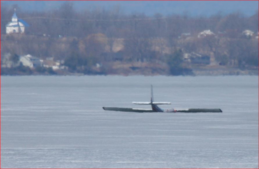
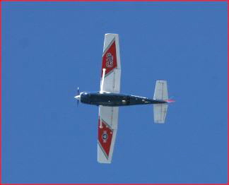
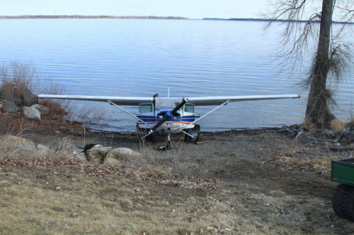
The plane around 9 AM on Sunday
Saturday April 11: about 12:30 PM: A Cessna 172 (single engine, four seats, high wing, fixes landing gear) did a touch and go landing on the ice off the VanEverest fishing access (Inland Sea, Milton west shore), The ice was about 18" thick. The over night temperature away from the lake: 31 degrees. At the time of the landing the temperature was about 50 degrees with some sunshine. There was a 20 mph NW wind. The ice type was S2 (0.4" grain size at surface). The ice had 82 thaw degree days since the last cold spell. The ice was well thawed through its full thickness.
When the main gear touched down, it left ruts on the ice surface about 1.5" deep. The front gear touched down and the plane was unable to generate enough thrust to get the needed airspeed to take off (about 70 mph). It broke through upon stopping, settling on the belly with water quickly rising to waist level in the plane. The pilot saw the need to abandon the plane before it settled further, possibly trapping the occupants. The passenger was focused on getting sufficient location information to controllers at the Burlington Airport. The pilot forced the issue and both men abandoned the plane, one keeping is torso reasonably dry and the other got pretty wet. They walked about 3500 feet to the Van Everest access on the east shore of the Inland Sea. It was cloudy, windy and near freezing. A lady who came to fish called 911 when saw what was happening. When the men got to shore put them in her car to start to warm up. The wetter victim went to the hospital for an examination and rewarming.
The following reviews the events with a focus on the role the ice played.
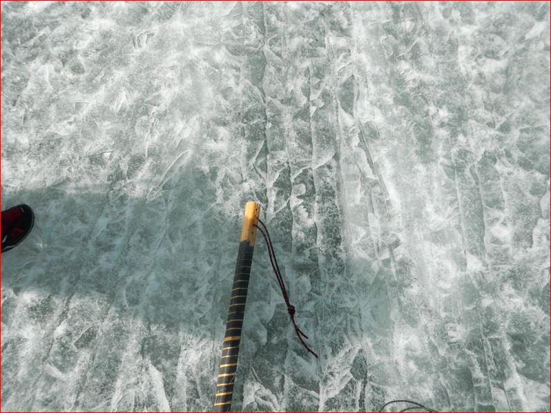
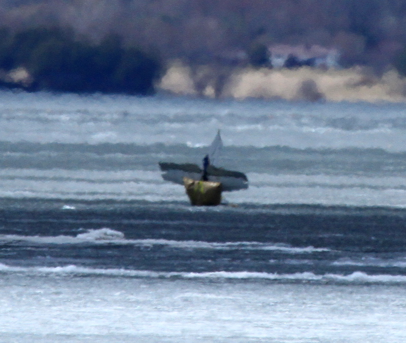
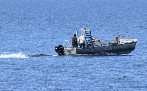
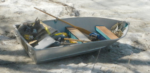 The boat used to move equipment to the airplane for placing the airbags to keep it from sinking to the bottom of the lake.
Sunday April 12: A salvage operation was started as soon as the crew could pull things together. The ice was too weak to lift the plane out. Thee 2000 lb (flotation) airbags were placed on the plane by 1:30 PM. By then the temperature away from the ice was approaching 70 and it had been full sun all day. There were now 100 thaw degree days in the ice.
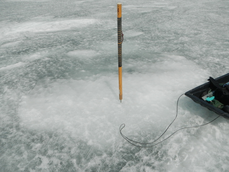
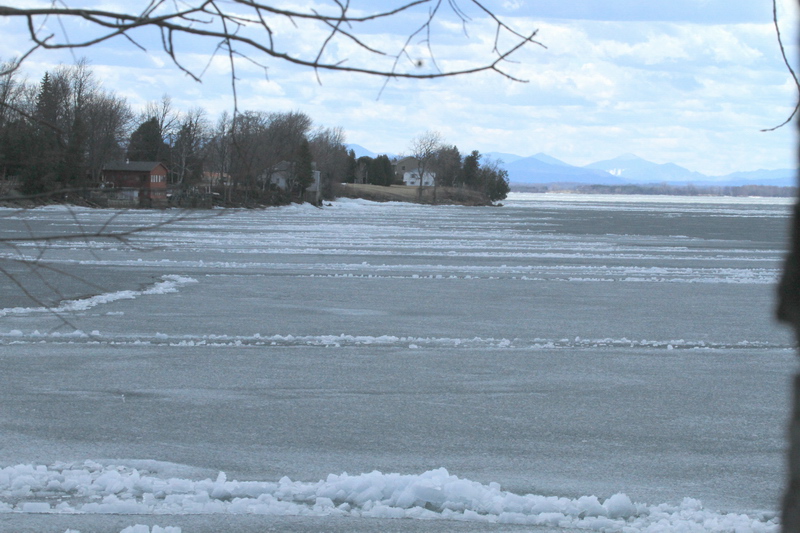
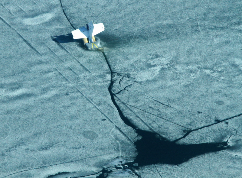
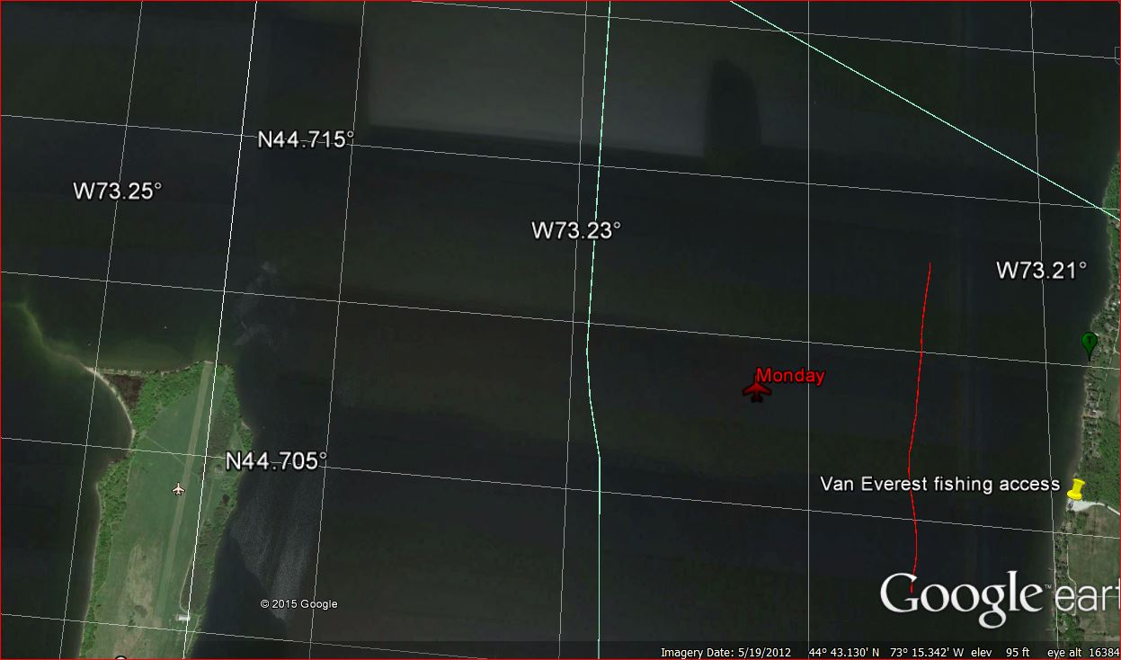 The plane's position on Monday (it did move much until Thursday night). The vertical red line is the approximate boundary of the weak S2 ice to the west and the stronger agglomerate S1 ice to the east.
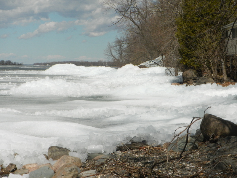
There was a band about 1700 feet of agglomerate ice along the shore. Several measurements showed a thickness of 18". It had many soft spots (snow ice pieces that were soft for about 3", enough to give you pause when you stepped on them but they had harder ice underneath). There were some darker areas that were thawed enough to shift when you stepped on them. You could hear the ice shifting several feet from where you were. We could not drive a test pole though this ice. Whiter areas were more solid.
18"agglomerate ice. It's pieces are rotated to vertical from the pressure of an unfrozen ice edge veing pushed by westerly winds. This ice came in in early January.
 2-1/2" thick vertical pieces of broken S1 ice (aglomerate ice) that formed as part of the edge formation along the down wind shore of the Inland Sea.
 A patch of snow ice that was part of the agglomerate ice.
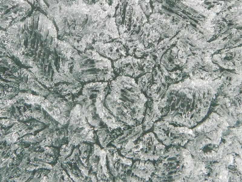
Scalloped S2 (fine grained) ice looking toward the plane and boat. Scale: the dark scallop pockets are roughly 2" across. This ice covered a wide area to the west of the agglomerate ice. It formed in wavy, cold conditions. The water initially forms flake ice what gets ground up by the waves. In an advanced thaw state this type of ice gets extremely weak.
By One PM on Sunday when we got on the S2 ice, the overnight ice was gone and the ice sheet was in thaw stage 5 most places (almost too rotten to hold you up). You could drive a test pole through the full 18" thickness with a hard stab followed by a steady push. The salvage crew stepped or fell through a few times as they worked around the plane and came back to shore (thaw stage 6). The plane was resting on its wings and the airbags when we left the fishing access around 2 PM.
 Closeup of the S2 ice (the long dimension of the bigger crystals is about 0.4"). Note the dark gaps separating the crystals.
This Civil Air Patrol Cessna 172 was one of many small planes that flew over the site on Sunday.
Monday April 13 9AM: The moderate wind forecast from a couple days ago has increased to gusts in the 40 mph range for Monday evening. This may enough to raft the ice sheet and possibly break up and melt the ice sheet. It is hoped that the plane will sink a little under the ice sheet and hang from the bags.
The plane had neither sunk more or moved horizontally by 2:00PM Monday. The S2 ice had gone from whitish pm Sunday to dark gray on Monday. It is very likely at stage 6 and on its way to stage 7 and disintegration. No finger rafting was seen in the ice sheet at this time.
Tuesday April 14 10 AM: It was windy enough and weak enough Monday night to raft the ice a bit. The plane sank a little further.
 The bottom of the tail of the plane and a yellowish airbag are all that could be seen on the surface on Tuesday.
 Looking along a finger rafted band of ice toward what later became the take out point. The rafting direction was from right to left (generally from the west). This band ran for long distances along the shore with ice piles in a few places. In general the overlap was about 100 feet.
 Ice piles formed when the double layer of rafted ice intersected with the shore. Perspective: looking north along the Georgia Shore.
April 15 4:30 158 thaw degree days since the last cold spell. The ice is getting weaker but there has not been enough wind break to up the weak ice. Last year it took a wind in the mid 30 mph range.
 MODIS Satellite image for April 15. Burlington to Venice Quebec.
A friend took two of us up in his plane to have a look.
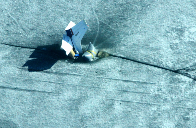 Two of the three airbags are visible as is the inrun track of the plane.
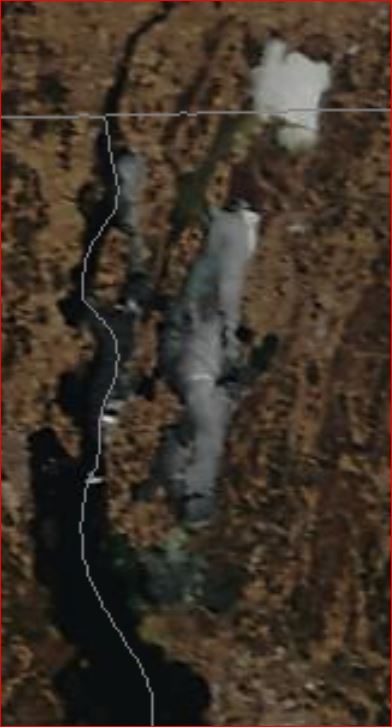
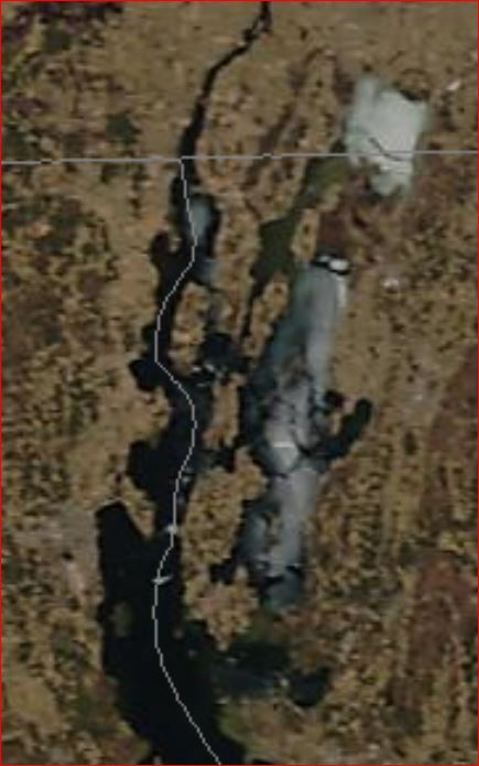
 The hole at the bottom of the image is where the plane broke through. The hole was most likely created by the weight of the stopped plane rather than the plane rolling into a preexisting hole. The shifting and rafting of the ice early on April 14 separated the plane from the crash position by 40-50 feet feet. The entire ice sheet moved north at least a couple of hundred feet.
 When we first reviewed the pictures from this flight we thought we could see tracks from other touch and go's however on closer examination the only actual track is the one that starts in the lower center and diagonals slightly to the left as it goes up the image to the hole made by the airplane when it stopped. A pair of straight parallel lines (rising from the from the left bottom edge) are not quite the right spacing. There is also a pair of rougher parallel lines that run along the top edge that also did not have the right spacing.
April 16: The winds during the day were light and there was roughly 80% of full sun. The ice along the shore is melting and pulling away. Everything near shore was in thaw stage 7 (far too weak to hold body weight). The plane and ice appear to have moved north a moderate amount (few hundred feet?).
 Modis image for April 16.
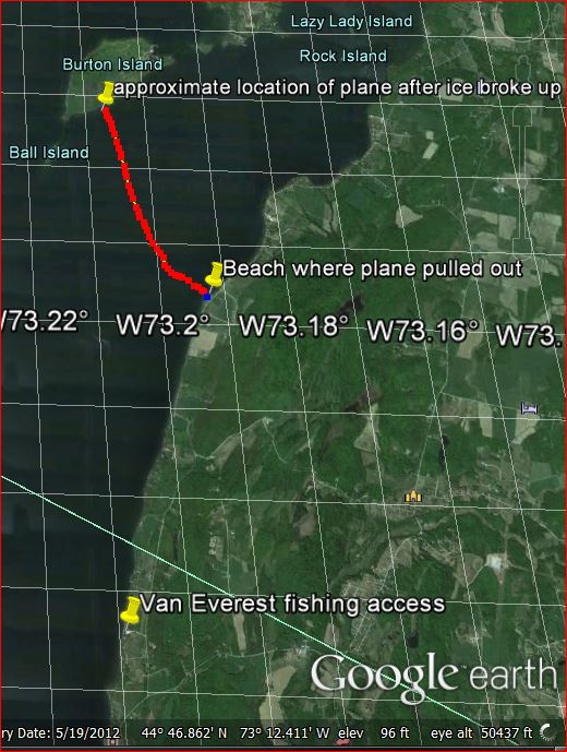
April17: Friday It got reasonably windy over night. At Colchester reef the wind was south with 20-22 mph sustained and gusts to 25. This was sufficient wind to force more finger rafting of the weak ice sheet, expose more open water, mix the open water at the surface with slightly warmer, deeper water which melted almost all of the ice sheet. The ice-sheet on the 'inland sea' was about 25 square miles. The plane was trapped in the ice sheet, so it moved north with the ice sheet for about 6 miles. It was found on the southeast shore of Burton Island about 1/2 mile from the SW end of the island.
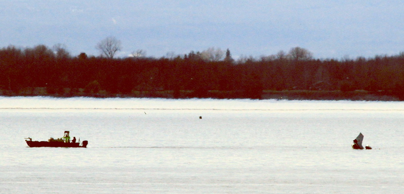
 Larry's work boat on the way to hook up the plane.
 The plane in tow.
After trying unsuccessfully to rearrange the airbags to make the plane closer to horizontal they started pulling the plane. The speed was about 0.43 mph with an estimated arrival time at Van Everest fishing access of 11 PM. A resident was watching the progress from his shoreline property. He was able to hail the towing team and offer to let them take out the plane there. They had the plane out of the water before dark.
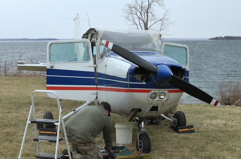
The plane on the beach. Visible damage included denting of the wing leading edges and the front cowling...not all that much considering where it had spent the previous week. The general consensus is that the plane will be sold for parts.
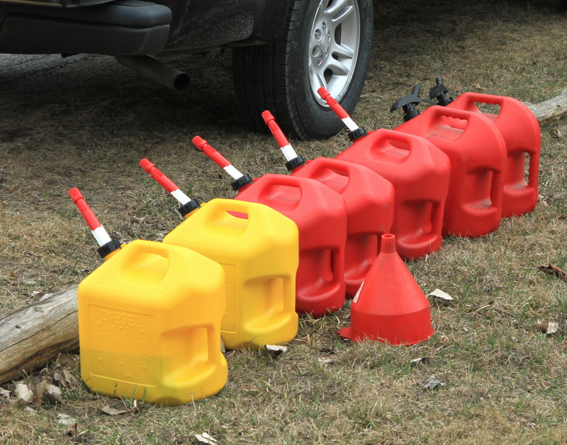 Fuel removed from the plane.
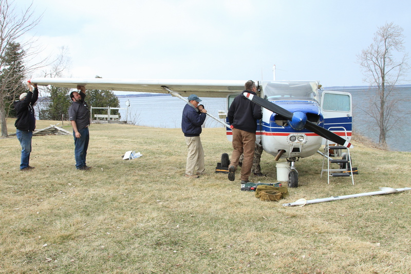 Wings being removed
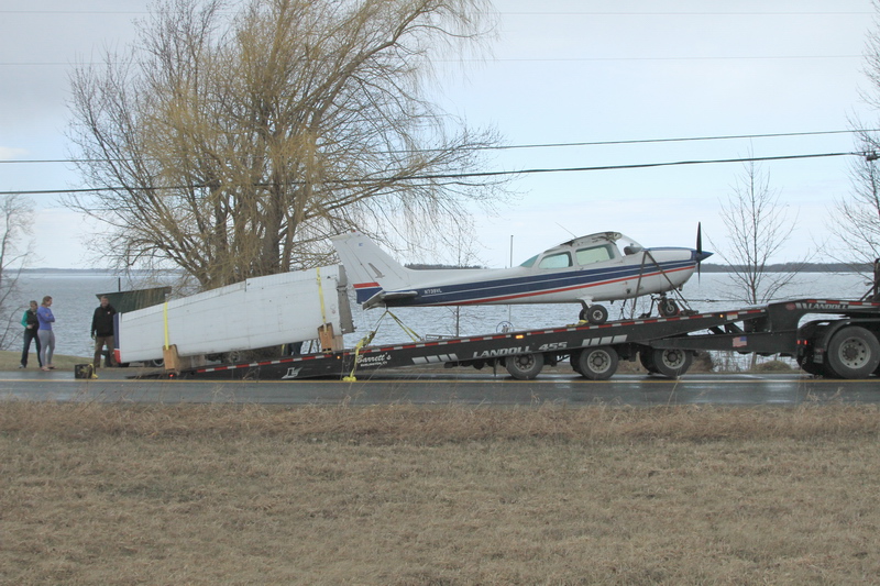
On the truck, with fixtures to hold the wings. If you ever need to haul a small airplane in Northern New England, Barrett Trucking has the equipment and skills to do it.
Bob
 robertdill